Saturday, August 20, 2011

The Functionality of the Scheme's Documentation

The accessibility of governance documentation of all kinds has increased exponentially in the parts decade. It can be increasingly assumed that members of a constituency have access to the Internet. Likewise, it is relatively safe to assume that members of ‘the public’ can access Council’s planning documentation online. It is even the case that increasingly this is the preferred method of accessing information relevant to governance issues.

In accord with this, Internet facilitated ‘social networking’ is increasingly a dynamic at play within contemporary community life at some level. While all this is true, it is not yet the case that ‘administrations’ on the one hand have fully embraced the opportunities this social development offers and on the other have over estimated its value and functional value.

Essentially
, given the relative newness of the communication paradigm, administrations do not always design their communication and social networking all that well. Nonetheless, the opportunities for governing bodies to work more closely, and more inclusively, with their constituencies (COIs) represents a paradigm shift in planning terms.

This is ever likely to be the case given the current pace of change not to mention the dimensions of these changes. In essence everyone is always playing catchup.

‘That said, it is clear that the need for hardcopy manifestations of things such as maps, reports, assessments, etc. remain but not always in a single format. Indeed, one of the strengths of digital communication is that it can deliver a multiplicity of outputs to fit the various ways they may be best read and/or used.

As evidenced by the public consultation related to the Draft Planning Scheme at Town Hall, large unwieldy topographical and street maps fit the purposes of professionals working alone are not so useful in many other situations. There is a strong case to be put that developers, and planners outside council, need this kind of data in a more manageable format – digital or hardcopy .

Given that digital documentation is able to readily provide this kind of material there is a case to be put that in addition to the large format presentations of documentation there is a need for ancillary, and more manageable, documentation to be made available online and in a hardcopy format for easy reference where appropriate. Ideally hardcopy versions of the planning data needs to be lodged with public libraries fir research and other purposes.

Given that A4 is the format of choice for most office and home printers it would offer the most useful format for the purpose hardcopy and digital archives.

This will mean that maps in particular will need to be tiled as they are in standard street directories but so be it. Where this is inadequate more appropriate formats can be downloaded from the Councils website and printed in a growing number of businesses and/or at Council if need be.

The key factor here is to facilitate multi-functional versions of
planning data rather than control the manner in which this kind of information can be accessed and read. Furthermore, there needs to be some effort devoted to making digitised versions of planning data more able to be interfaced with like information 'off-site'.

Planning Approval Processes

It is apparent that the city’s planning and approval processes are primarily designed to be administratively expedient. This does not always lead to equitable outcomes or indeed appropriate outcomes relevant to the maintenance of streetscapes, cultural placescapes and/or cultural landscapes a 'development' will have impacts upon.

Likewise, expedient development approvals may not always take full account of a range of issues that may have adverse impacts upon property owners within the area it is proposed that it take place and the amenity they expect to enjoy – indeed have a right to expect to enjoy. For this reason more than any other there are appeal processes in place, but not always.

Currently, there are Development Applications that need to be vetted by Councils Planning Dept. and then advertised and made publicly available for comment by other property owners and residents.

Then there are other developments that are dealt with exclusively ‘in-house’ where adjoining property owners do not get the opportunity to scrutinise the development proposal or comment upon it. These developments proceed on the say so of Council Officers without there being any real opportunity – informally or formally – for aggrieved property owners to present their case.

For a large proportion of cases this approval strategy works well enough but it does open up opportunities for poor outcomes given the contingency of 'human error' and ill informed proposals. In some instances there is likely to be unsatisfactory (inequitable?) outcomes and should the development be on a slightly different location there is case to be put that the outcome might well be different (better?).

An exemplar of this is where a development over the fence (the boundary) from a Scenic Management Zone can proceed without there being an opportunity for the neighbourhood to have an input into its appropriateness for the area streetscape, placescape, cultural landscape, etc. Here trees can be removed virtually without restriction whereas next door they would need to be retained given that they are deemed to be within a protected skyline – and by-and=large subjectively.

Arguably, in such instances, this is less than best practice, and in worst case scenarios, it may well lead to an inequitable outcome. Whatever the reason there are good arguments to suggest that the outcome may well be poor – and likely to be inconsistent with the cultural placescape or cultural landscape.

Clearly this situation comes about out of a need to process Development Applications as quickly and as efficiently as is possible and practical. If that is the outcome well and good but when it is not there is every possibility that there may be paucity in the outcome that might have been avoided if there was some engagement with the Community of Ownership and Interest (COI).

There is a case to be put that there may be two planning approval processes:
  • One where there is overt efforts made to ensure that a potentially contentious planning proposal is approved by-and-large in accord with the current Development Application process – instances where Scenic Management, heritage and/or other issues are clearly in the approval mix; and
  • Another where a developer simply notifies adjoining property owners of an impending development thus allowing them to make representations to both the developer and Council planners in the event there is an adverse element in the proposed development.
In the first instance the current Development Application and approval process can be said to be working well enough given that the process has been developed over time and that it has within it checks and balances.
CLICK ON THE IMAGE TO ENLARGE
In the second instance here, a Development Notification and approval process offers an opportunity for adjoining property owners and residents to be included in the planning approval process. For the most part the city’s planners would be the drivers of the process.

However, near residents would have a direct opportunity to protect the amenity of their neighbourhood, streetscape, cultural placescape and/or cultural landscape, when and if that were to become an issue. Currently these concerns are dealt with bureaucratically, and from a distance in isolation, and in ways that cannot be expected to be reliably ‘place sensitive’.

In the end every precinct/street/neighbourhood is a cultural placescape cum 'cultural landscape' [2] that deserves:
  • Sensitivity to the cultural determinants that shape the place;
  • To give those who live and work within 'the place' a sense of belonging/ownership; and
  • Respect for what residents and property owners have invested in the places they live and work in.
Planning processes that are 'bureau centric' are typically careless about the cultural imperatives of place and more concerned with decision-making than they are with placemaking. Increasingly communities are gaining the tools – Internet facilitated social networks etc. – to challenge inappropriate and inadequate decision making – particularly those that exclude constituencies from decision making processes.

Community wellbeing is largely dependent upon the capital it has invested in the communities and places people belong to – economic capital, social capital, cultural capital & natural capital. In the end 'civic planning' is to do with ensuring that a place's Community of Ownership and Interest (COI) is well served by civic decision-making and placemaking.

Protecting The City’s Natural Capital


The draft plan does set out to protect 'iconic' natural assets such as the Cataract Gorge, parklands and recreational spaces. That said it is relatively silent in regard to issues such as water management, the city’s ‘carbon storage’ capacity, resource recovery, agricultural land management or eco-environments.

It is not within the scope of this paper to discuss this issue(s) in any detail. Nonetheless, beyond the ‘iconic’ features in the landscape, Tassie devils and tigers, etc. – within the municipality there is need to more appropriately – overtly and proactively – address the issue of ‘Natural Capital’ from a planning perspective.

A case in point is the way that stormwater is imagined in the city. By-and-large , in Launceston, it is regarded as either a threat or a nuisance – or as waste ... something in need of expedient disposal. A more profitable and environmentally appropriate way to understand it would be to regard this water as a resource to be managed for the benefit of the residents, the landscape and the environment.

Doing so would simply be a matter of catching up with Local Govts elsewhere – places that see and understand the value in managing water with 21st C sensibilities in play.

Rather that piping stormwater to the nearest river, stream or watercourse replete with the dross of urban life – animal excrement, motor oil, chemical spills and other waste matter – it needs to be fed into the landscape as near as possible to where it falls and returned to the ecosystems that depend upon it – and in as good a condition as possible.

Alternatively, stormwater might be captured, stored and used on site as a replacement for reticulated water albeit that might not include drinking water. There is a compelling case to be put that wherever a landscape has been modified there is a need to slow water’s flow across it and return as much as possible to the landscape – and do so without putting the built environment and civic infrastructures at risk.

The notion that in ‘engineering terms’ this is too difficult, too expensive, too onerous, whatever, is no longer an acceptable response. Indeed, it is a lazy response given that the technology for achieving the outcomes described here is relatively well understood. Moreover, these technologies are well within the reach of anyone seriously concerned with achieving the kind of target outcomes implied here.

What is true for water is true for other issues in natural capital management. Moreover there are profits – tangible & intangible – to be won by being proactive in regard to natural capital management.

It is timely that Local Govt. planning begins to proactively address natural capital in their planning schemes, and less simplistically, and in ways that deliver more holistic outcomes for the Communities of Ownership and Interest (COI) they serve.

Council Media Release Issued: 15 July 2011


The Launceston City Council is calling for community feedback on the draft Launceston Planning Scheme 2011.

Launceston City Council Mayor Albert van Zetten said "This is a vital document for Launceston
as it outlines the Council's vision for the future development of the city. The Scheme potentially
impacts all residents and land owners in the municipality so community consultation is a really
important part of this process.

"The draft Scheme will be available online at www.launceston.tas.gov.au on CD from the Council's Customer Service Centre or hard copies will be available to view at the Customer Service Centre from Monday 18 July 2011.

"Residents are also invited to take part in the process by attending one of the open ‘drop-in’
information sessions being held across the municipality.

"Drop-in sessions will be held at:
Launceston Lilydale
25 July 2011 from 3pm to 8pm 26 July 2011 from 3pm to 8pm
29 July 2011 from 3pm to 8pm Old Court House and Library
Town Hall Committee Room Main Road, Lilydale
St John Street, Launceston

Rocherlea Kings Meadows
28 July 2011 from 3pm to 8pm 1 August 2011 from 3pm to 8pm
Northern Suburbs Community Centre Kings Meadows Bowls and Community Club
Archer Street, Rocherlea 18 Carr Street, Kings Meadows

"Comments can be made in writing by emailing planningschemereview@launceston.tas.gov.au
between 18 July and 12 August, by visiting www.YourVoiceYourLaunceston.com.au or to a Council officer at the drop-in sessions.

"The draft Planning Scheme proposes a number of important changes to the Launceston Planning Scheme 1996. These changes include:
  • An Urban Mixed Use zone is proposed for the land surrounding the Central BusinessDistrict (CBD) to promote a wider range of 'urban' uses including residential, business, tourism, leisure and community uses.
  • Provisions have been developed to facilitate inner city residential development including higher density residential development in the upper floors of buildings.
  • Additional residential land has been provided for integrated urban growth over the next 10 to 20 years. Over 254 Ha in some 45 parcels has been allocated to vacant residential land. This approach is optimistic and designed to ensure that the housing market is supplied with sufficient land in a variety of locations over the plan period.
  • Provision for industry focuses new development on existing vacant land, promotes brownfield redevelopment of derelict sites and provides for some limited green field development. The planning scheme would provide almost 100 Ha in over 50 parcels of vacant land. This provision effectively provides a choice of locations while not fracturing demand or reducing the viability of existing areas
  • The scenic protection provisions have been revised to make them more relevant to specific areas. A precinct based approach is proposed. These provisions are less generic and should improve the quality of outcomes for these areas.
  • The heritage provisions have been significantly revised and expanded to reflect the value placed on heritage by the city. A number of heritage precincts have been identified in accordance with the Launceston Heritage Study. These will be progressively implemented following the adoption of the scheme.
  • Increased provision has been made for cycling and walking including specific requirements to provide facilities through the development assessment process. There is also increased consideration of public transport integration in new developments and subdivisions."
Mayor van Zetten said "The Council will consider the community's feedback and the redrafted
document will be presented at a Council meeting for endorsement. The finalised Launceston
Planning Scheme 2011 will then be sent to the State Government and the Tasmanian Planning
Commission for approval. The Council is aiming to complete this process by the end of August
2011."

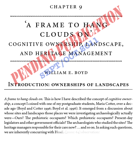
Prof Bill Boyd: Publications on 'Cognitive Ownerships'

Introduction: Dr Bill Boyd B.Sc.(Hons) St Andrews, Ph.D. Glasgow, D.Sc. St Andrews, FRGS, FIAG

Current Positions
  • Professor of Geography, School of Environmental Science & Management
  • Chair, SCU Human Research Ethics Committee, and Animal Care & Ethics Committee
  • Director, Southern Cross Environmental Innovations Research Centre
Bill Boyd is Professor of Geography at Southern Cross University, Australia, with special interests in long-term environmental change, the history of landscapes, and cultural heritage management.

His interest in the ‘cognitive ownership’ of places by multiple ‘owners’ developed out of the need to engage with issues surrounding the management and preservation of archaeological sites, and in particular in whose service such management was required. Although located here in examples from Australia, the concept is one that has ramifications for all those involved in public archaeology and heritage. It takes us beyond the concept of (mere) ‘stakeholders’ into that of shared and competing communities of interest—thereby creating a useful counterpoint and complement to other chapters in this volume (e.g. Smith and Waterton; and Schofi eld, Kiddey, and Lashua).