Saturday, August 20, 2011

The Scheme as Presented

The documentation for the Draft Planning Scheme, as presented, contains a series of weaknesses and problems. This is demonstrated at the very beginning of the documentation in so much as it does not articulate a clear and unambiguous purpose – [1] [2] [3].

Rather than a ‘purpose’, the draft planning scheme articulates a ‘requirement’ to be meet and more specifically to meet two sets of objectives ... “To further the Objectives of the Resource Management and Planning System and of the Planning Process as set out in Parts 1 and 2 of Schedule 1 of the Act … and ... To achieve the planning scheme objectives set out in clause 3.0 by regulating or prohibiting the use or development of land in the planning scheme area.” It would be more useful, and more appropriate, to head this statement 'Legislative Context' – and immediately after the 'Statement of Purpose.'

Interestingly, the list of individuals, organisations, businesses, corporations, institutions, etc. that are not required to comply with these objectives would be very short. Arguably there would be none that the scheme would address itself to.

While statements of purpose may appear within the draft scheme's zoning and codes they do not cover the necessity for the scheme to have an overarching purpose as a reference for the assessment and application of the scheme. A planning scheme needs to purposeful!

By its own definition, the ‘purpose’, as stated in the document, fails the relevance test given that it is stated that it is an ‘objective’ and at the same time fails to articulate the scheme’s purpose for being.

As a strategic document, and one that is intended to have strategic utility, its purpose must be both clear and unambiguous. Indeed the document’s purpose needs to be articulated within the document and provide the discipline of a referential overlay that its various elements need be demonstrably fit for and consistent with the overarching ‘purpose’.

Clearly, simply meeting objectives does not do any of this. While ‘planning’ is primarily about achieving objectives and goals these objectives, in order to be meaningful, the process needs to be purposeful.

For example, a fire bucket’s purpose is to contain and carry a substance – water, liquids, sand, etc. Given that it is fit for purpose it may fulfil an objective in, and play a part in, extinguishing a fire. However, arguably its purpose is something other than extinguishing fires even if it is made available to play a role in putting out a fire.

In so much as a fire bucket is useful in extinguishing a fire this objective can only be realised by someone with the intent of extinguishing the fire and the competence to do so. By itself the bucket can neither ignite nor extinguish a fire albeit that it has the potential to play an important part in either role depending upon the intent of the user.

Arguably the purpose of something like a planning scheme is relatively subjective and open to conjecture. Nonetheless, to be meaningful, such a scheme needs a clear purpose and ideally one that is inclusive and one that fulfils a set of needs identified by the community it is designed to serve.

Given that in a ‘community’ it is generally recognised that there is a need to regulate and facilitate development, as well as one to maintain and preserve the wellbeing of a Community of Ownership and Interest (COI), one would expect to find some of these words in a ‘Purpose for Being Statement’ in order to meet the governance needs of a Council in accord with its constituency’s needs and aspirations.

Purpose is a matter of policy. A key benefit of a well defined Statement of Purpose is that it focuses an organisation's /community's energies and clarifies its raison d’être.

To the extent that the draft document inadequately articulates a clear and unambiguous purpose it demonstrates that thus far it has not been designed to meet governance needs or community aspirations. Rather it bears all the hallmarks of being driven by administrative imperatives. Indeed, it is clear that thus far it has been prepared in isolation from its Community of Ownership and Interest (COI), and arguably within a framework that is insulated against COI input.

The schemes statement of purpose might read something like as follows:

"The purpose of Launceston City Council's planning scheme is to:
  • Regulate the development of the city in an equitable an orderly manner;
  • Facilitate the ongoing development of the city's infrastructure and services;
  • Promote social cohesion while building upon the city's social and cultural capital;
  • Maintain and preserve the city's heritage values; and
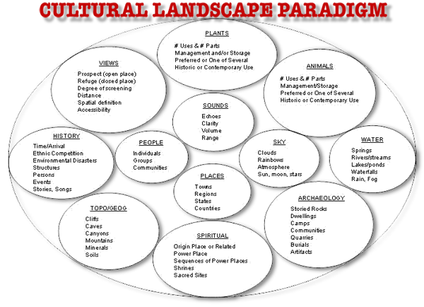
  • To do these things while paying respect to the municipality's cultural placescapes and cultural landscapes; the environmental values invested the municipality; and the ecosystems these things depend upon."
The question hanging in the air here is whose role is it to determine the city's planning scheme's purpose – its raison d’être and how should it be arrived at – and when?

The Scheme's Objectives & Goals

It is not within the scope of this paper to explore every detail of the Draft Planning Scheme’s Objectives. Rather there are overarching issues within them that can be addressed in a general way and that arguably need attending to in order to enhance its effectiveness.

It is assumed that the objectives as set out have some veracity and utility. However, this may not always be the case, as it seems that thus far they have been framed in isolation from the scheme’s Community of Ownership and Interest (COI). Likewise, the scheme does not articulate its status as a policy document.

If the scheme’s objectives and goals were to be individually tested against an unambiguous raison d’être almost certainly a need would be found to either revise or amend various items – and very likely, add further objectives and goals.

In respect to the scheme’s overarching purpose it is not possible to test the objectives/goals set out against its purpose given that the scheme articulates its purpose as simply meeting a legislative requirement and that requirement is in a state of flux. In the case of a purposeful planning scheme it is possible to do this test. Sadly this is not so with this draft scheme, except speculatively.

Importantly, linked to each objective there is explanatory text that rationalises the objective and puts it into context. It would be helpful to readers if this text were to be headed ‘Context’ or ‘Rationale’ or something like ‘Guiding Principles’. This would add to the documents utility – and add substantially to its readibility.

To the extent that there is no articulated ‘Purpose’ it is difficult for readers to back reference and contextualise the objective/goal in relationship to an issue in hand and the planning process – ideally a process that goes on well before a plan is presented to Council for approval.

What is missing from this section of the documentation is an articulation of the ‘Strategies’ that will be used to bring about a targeted outcomes. Neither does the draft scheme put many of the necessary tools in professional planners' hands or tools that would assist in marketing the planning process and/or the scheme's raison d’être.

All this seriously impinges upon the document’s utility as a policy instrument in that it does not offer enough guidance to developers and external planners in developing a project that is best able to comply with the scheme. While it may be true that a developer will typically test the extremities of any planning scheme clarifying policy imperative is likely to remove at least some of the tension in contesting various interpretations of the scheme.

Indeed, there is a strong case to be put that the document needs a flowchart that demonstrates the process of initiating a project/proposal and how it will be progressed through the approval process, and by whom, and within what time-frames, in order to facilitate target outcomes with greater efficiency and effectiveness – and in the end amicable compliance.

In order to be an effective civic document a planning scheme needs to be able to be interfaced with other Council policies and Council's marketing of its programs and strategies.


Scenic Management


At the outset it needs to be acknowledged that ‘scenic management’, as a concept, is subjectively determined and assessed. Given this, there is ever likely to be contested values when it comes to development proposals and placescape cum landscape maintenance and preservation issues – in both a wider and local context. The development and/or the management of a site/placescape/landscape inevitably involves the making of subjective judgements and typically by parties with different interests, sometimes conflicting interests. In addition, judgements would be made from 'narrative points of view' informed by various cultural sensibilities.

Collectively, the people making these judgements might be better understood as a site's, neighbourhood's, placescape's, precinct's and/or a landscape's Community of Ownership and Interest (COI).

In respect to ‘Scenic Management’ [1] [2] , Launceston’s Draft Planning Scheme makes a set of assumptions that are arguably overly simplistic and largely unhelpful for a planning purpose that aims to deliver well-being outcomes to the municipality's constituents. For example, the points from which the ‘scenic values’ are assessed from are typically remote vantage points – that is geographically remote and by-and-large bureaucratically remote as well.

Given all this it must be acknowledged that the issues related to scenic management are more complex (more layered?) than those the scheme seemingly aims to address – and from the narrow perspective that it does.

Given this, there is a case to be put that this component of the scheme is inadequate to contemporary understandings of, and community expectations of, civic planning issues and current concerns relevant to good civic planning in a 21st Century context – along with the social and cultural issues a planning process needs to embrace.

That said, mono-dimensional bureaucratic assessment is of little or no assistance to a planning scheme that aims to avoid, rather than promote, the adversarial resolution of disputes – that is characteristically granting, or not granting, approval for contentious projects/development and standing back to wait for objections. A multi-dimensional cum multi-layered approach might well be one that takes account of ‘scenic issues’ from a distance, and at close quarters, and simultaneously accommodating different and divergent sensibilities – social and cultural.

A more inclusive and holistic approach to Scenic Management may well take account of various vantage points on 'low ground' and likewise from 'high ground' vantage points. 21st Century technologies facilitate a site's/precinct's COI assessing landscape planning issues via the Internet. This access is becoming increasingly sophisticated.

In a municipality like Launceston, scenic amenity should not be assessed exclusively from a distance and especially so given the city's history and heritage. Rather, the amenity needs to be examined from near quarters – a placescape, a streetscape, a precinct, a neighbourhood – as well as from a distance – a road, a tourism precinct, the CBD, Town Hall even. The Draft Planning Scheme tends to privilege the distant perspective – a Town Hall bureaucratic perspective. In the end, and as a consequence of this, the draft scheme is relatively careless about the cultural placescapes and landscapes these distant perspectives celebrate and include – and that the scheme might aim to protect, enhance and regulate.

For instance, ‘Scenic Management Areas’ in the draft scheme are bounded, and almost incredulously, by ‘hard borders’ which has the effect that a tall tree on the non scenically managed side of the ‘border’ is strategically deemed by ‘the plan’ to be outside the area of management. That is even if it is a significant feature on the scenic skyline that the plan aims to ‘protect’ and one that is a valued landscape feature within the placescape/precinct/street/district/neighbourhood/landscape.

This may mean that a development on one side of a fence can proceed without planning restrictions or a need for consultation with near residents. It might have buildings with brightly coloured reflective surfaces while all the vegetation on the site may be removed – and with impunity. Yet on the other side, a totally contrary set of planning restriction will apply. This can happen, it would seem, without the precinct's and other placescape's other property owners having an opportunity to comment on a proposed development and its fitness for the cultural placescape and cultural landscape it will be a part of. This kind of development may well have a negative impact upon the amenity of the place/precinct – environmental, social and cultural – and an impact upon property values as well.

On face value the draft scheme is careless about this situation and seems to offer little in the way of mitigation when viewed from a cultural placescape cum cultural landscape perspective. Indeed, in the draft scheme a relatively minor anomaly on Trevallyn has arguably been translated into a more problematic and anomalous planning issue from a cultural placescape cum cultural landscape cum precinct amenity perspective. If this case exists so too will many others.

This instance is an exemplar of the overly simplistic perspective 'scenic management' is viewed from in the draft scheme. Here the scenic vista from Town Hall is privileged over and above cultural placescape and cultural landscape perspectives – if indeed they have been considered at all. Arguably, they appear not to have been taken into account.

To compound the issues/problems here the 'operating sensibilities' are likely to change over time as personnel within Council change and offer different subjective assessments of the issues. Likewise, the property ownership matrix is likely to change also bringing different sensibilities to bear on cultural placescape/landscape perceptions.

Arguably all this is problematic, anomalous and divisive even in worst case scenarios. It also points to a class of weaknesses within the Draft Planning Scheme and that arguably should be addressed in the plan given that these weaknesses have seemingly been either overlooked or ignored thus far.

In respect to the situation described above, an ‘explanation’ has been offered that the method used to determine the ‘borders’ of Scenic Management Areas is something described as a “Military Crest”. This concept may well have utility in determining military strategies but does it have any relevance to civic planning? Debatably it has little or no value in civic planning or civic planning strategies because there is no war/conflict to be won except for those generated by the planning scheme, rather there are cultural sensibilities to be accommodated and cultural placescape/landscapes [2][3] [4] to be protected, preserved and celebrated.

In Scenic Management the utility that it seems is being regulated, and protected, is aesthetically determined, and subjectively, and for the benefit of tourists – people who for the most part live elsewhere. The narrow ‘point of view’ from which scenic management is perceived needs to be reviewed to facilitate better strategically driven, culturally sensitive planning strategic outcomes. There is more at risk in these placescapes/landscapes than the risk of offending the aesthetic sensibilities of tourists or visitors to the city and thus the income possibilities of tourism operators bureaucratically determined for the benefit of stakeholders rather than the precinct determined Community of Ownership and Interest (COI).

Planning and Communities of Ownership and Interest

Communities of people have many items in which they share a sense of ownership - for example places, streets, roads, schools, neighbourhoods, a health service, even a landscape. Those with such an interest form the Community of Ownership and Interest its COI – for those items.

All too often a COI's shared ownership and interest is down played and may even be belittled or denied, particularly when contentious or complex issues are involved. Community planning typically bumps up against competing interests in a placescape and/or landscape. However, recognising the layerings of ownerships and interests, and the social cum cultural dynamics involved, can offer a way forward in dispute resolution – ideally local governments' planning processes need to engage with Communities of Ownership and Interest.

If we listed items that had a COI we would include items and locations that were owned by the public – public places and spaces – such as a park; a street and/or a neighbourhood; a river, a monument and/or memorial; an institution and/or a heritage building; a museum; a water supply and/or a forest; a festival and/or a ritual; clearly the list is as endless as the kinds of attachments – economic, social & cultural – people have for places, things and events.

Indeed, individuals within a place’s/event's/space's COI will almost certainly have multiple layers of ownership and interest in it. The ‘truth’ in the ownership and interest here is ‘cognitive,’ a matter of ‘lore’ rather than ‘law’ that which is taught; hence to do with wisdom; concerning cultural knowledge, traditions and beliefs. It pertains to cognition, the process of knowing, being aware, the acts of thinking, learning and judging. If we take a placescape as an exemplar, placescapes are to do with cognition – musing; the contemplative; the meditative. Albeit imperfect 'lore is determined subjectively.

If we look at courts, then they are to do with power over conduct; enforcement and authority; control and regulation, guilt and innocence – none of which have much relevance to do with musing places, nor much to do with musing per se. Courts look for guilt or innocence corroborated by evidence. Albeit imperfectly, 'law' is determined objectively.

Furthermore, members of the COI should be understood as having both rites and obligations commensurate with their claimed ownership, expressed interest and their relationship to say an institution and its overall enterprise; a placescape and those who share it; a landscape and those with whom they share a role in shaping and managing it; etc.

A member of the COI may also be referred to as a “stakeholder” but stakeholdership in its current usage has generally come to mean a person, group, business or organisation that has some kind vested or pecuniary interest in something or a place. All too often stakeholderships are contentious and in some scenarios they may even be blighted by conflicts of interest given the ways the 'convention' has been used more recently.

Typically, 'stakeholders' assert their rights when there is a contentious decision to be made. However, 'stakeholders' are rarely called upon to meet or acknowledge an obligation. Conversely, members of a COI will have innate or unexpressed understandings of the obligations that are expected of them and the rights they expect to enjoy – indeed, there is very likely to be stakeholders in the COI mix.

It is just the case that for a placescape say, the COI mix, when assessed from outside and within, is intentionally, functionally and socially more inclusive. That is more inclusive than say a list of stakeholders drawn up in respect to a development project that governments – Local, State & Federal – typically make decisions about.

Stakeholder groups and Communities of Ownership and Interest are concepts with kindred sensibilities – law and lore, the former reinforcing the latter. Nonetheless, they engage with different community sensibilities and dynamics; with different expectations and different relationships – even if sometimes many of the same people have a ‘stake’ in something as well as other relationships as a member of a COI.

Planning processes that do not pay due attention to Communities of Ownership and Interest are arguably inadequate – flawed and dysfunctional even.

Analogous
to a family, if like in a family the interests and aspirations of individuals, all of them together and at once, are not adequately taken into account the family may remain as an entity albeit as a dysfunctional one – and one of a kind that is unplanned.

Zonning and Codes


The draft scheme as presented by-and-large paints a picture of the status quo tweaked somewhat. It seems to assume that in accord with anticipated relatively slow population growth the pace of change in the city is likely to be equally slow.

While there may be some truth in that assumption economic and social circumstances are prone to dynamic change over short timeframes especially so to do with social paradigms. This applies to Launceston as much as it may to any community/region of its size in the Western world.

By-and-large the zoning is much the same as they have been for several decades except for some tweaking of boundary adjustments. This seems to reflect changing demographics more than anything else. In some ways this is understandable given the scheme’s need to comply with the State Government’s Resource and Planning imperatives. However, the question that needs to be asked is, what are the local social and cultural imperatives?

Likewise the codes set out in the draft scheme are similarly essentially status quo conventions and regulations. While on the one hand this might be expected, and to some extent reassuring, on the other, it might be taken as stagnation, ultra-conservatism and thus problematic.

Given the pace of change anticipatable in the current socio-economic circumstances it would be more than ‘desirable’ if local government planning schemes started to look at alternative and unfolding development paradigms.

The draft planning scheme is silent on so much but noticeably it substantially avoids anything that might be taken for being proaction in regard to:
  1. Cultivating and sustaining cultural placemaking, placescapes and landscapes;
  2. Water security and/or eco-sensitive water management – case study;
  3. Local employment creation or maintenance;
  4. The decentralisation of energy generation, renewable energy and sustainable energy generation;
  5. Resource management and resource recovery;
  6. Sustainability in the design of the built and natural environments;
  7. Food security and urban/periurban food production;
  8. Climate change mitigation;
  9. Cohousing and/or Eco-village design criteria and zoning – Swedish exemplar;
  10. Community engagement in planning issues;
  11. Property sustainability rating systems and their applicability in the region.
Essentially the draft planning scheme lays out what 'The Council’ plans to do while waiting for community objections. This paper cannot do more than alert readers to the paucity of the draft planning scheme and focus on a selection of key issues. It is unlikely that the scheme will be rewritten but there is a real need for it to be rewritten and for it to be more thoroughly researched – and in a 21st Century context.

Mapping the Municipality


The Paradigm
Local Government is likely to be faced with ever increasing demands to be more accountable and more inclusive socially. Likewise communities are becoming more assertive in regard to their right to be informed as well as being more engaged in, and having more influence in, decision-making processes – Government's, Councils' and other public institutions' decisiuons.

Faced with such demands, Council Officers, and a Local Govt's Aldermen/Councillors, should be looking for new ways to evaluate their performancein particular Aldermen/Councillors evaluating their own performance and the performance of their service delivers. Strategic planning documents such as planning schemes are instruments of governance and likewise they are very useful tools in this regard.

Organisations like ratepayers groups, social action groups, lobby groups, etc. are likely to be increasingly calling for, initiating, and themselves undertaking, 'Social Audits' to monitor and verify the social performance claims of Local Govt. – plus Local Govt. departments, community organisations and servicing institutions.

A Social Audit, and the Social Atlases that emanate from them, are important planning tools through which Councils can plan, manage and measure non-financial activities. They can also monitor and map both internal and external consequences of a Council’s social and commercial operations.

Social Atlases and Audits give an understanding of the administrative paradigm and the information it uses to make decisions. They do so from the perspective of the vast majority of people in the society for whom the very foundation of Local Govt is legitimised. Social Audits of administration means understanding the administrative system and its internal dynamics from the perspective of:
  • What they mean for the vast majority of people;
  • The people who are not essentially a part of Council or its machinery; and
  • The people for whom they are meant to work for.
Increasingly Social Auditing processes are outsourced. While there are strengths to this strategy the weaknesses in the outcomes are often to do with their generic nature and the lowest common denominators that all too often inform them. There is strong case to be put that Social Audit processes in Local Govt. context needs to engage wit htheir constituencies – the Community of Ownership and Interest (COI).

Current Data Sources
Currently Council seems to rely very heavily upon the work of the ABS (Australian Bureau of Statistics) and its Social Atlases.


While Social Mapping has become much more sophisticated in recent times and likewise both the quantity and quality of information available from the ABS has increased exponentially over time. Nonetheless, good planning needs more and more information to meet current community demands and expectations.


Furthermore, there is a need to more actively engage with the Council's COI relative to both Social and Cultural Mapping issues.

Launceston, 25 years ago, was considered one of Australia’s least multi-cultural cities. At the time, one of the ways this was demonstrated was by the makeup of public service staff in the city – University, Hospital and Council in particular. Cultural diversity, or cultural sensitivities and sensibilities, hardly figured in planning processes of the time. Indeed in some respects there was an antithesis towards multi-culturalism.


However, the situation has changed quite dramatically for the city and especially so for the university, hospital and council. This cultural shift is not currently reflected in Launceston City Council's elected representativesbut it needs to be said that this is pretty much the case nationwide. This may be problematic in so much as planning for Launceston may not reflect the dynamics of the city's current cultural makeup and diversity.

Indeed it is some time since a cultural survey/audit was attempted for the municipalityand perhaps not looked at all from a regional perspective.

The possibility that the perception 'at Town Hall' is that planning decisions can still be made within the kind of 'old paradigm' Eurocentric paradigm? but it needs to be discounted in order to better reflect current sensibilities. Given that a great many of the city's culturally diverse residents are temporary residents – students, contract employees etc – are increasingly key players in the city's economy, new cultural paradigms need to be embraced within the city's planning strategies if its planning processes are to be 'purposeful.'

The Draft Planning Scheme is relatively silent in regard to the cultural dimension of the city's planning imperatives. Given that the city is increasingly less dependent upon 'industry' for its economic base, thus arguably, the city's planning needs to be increasingly 'culturally oriented' – a celebration of the city's cultural realities.


The city's 'Cultural Capital' comes into play more and more relative to the city's economic and social wellbeing. The city's growing dependence upon tourism, and cultural tourism in particular, is a demonstration of this. Against this background there is a compelling case to be put that it is timely that the city be proactive in regard to:
  • Initiating local community driven Social and Cultural Audits to supplement consultant driven audits and surveys;
  • Reflecting cultural imperatives in the city's planning; and
  • Providing guidance in regard to the city's planning via its Zoning and Codes.

PLEASE CLICK ON THE IMAGE TO ENLARGE IT

The Functionality of the Scheme's Documentation

The accessibility of governance documentation of all kinds has increased exponentially in the parts decade. It can be increasingly assumed that members of a constituency have access to the Internet. Likewise, it is relatively safe to assume that members of ‘the public’ can access Council’s planning documentation online. It is even the case that increasingly this is the preferred method of accessing information relevant to governance issues.

In accord with this, Internet facilitated ‘social networking’ is increasingly a dynamic at play within contemporary community life at some level. While all this is true, it is not yet the case that ‘administrations’ on the one hand have fully embraced the opportunities this social development offers and on the other have over estimated its value and functional value.

Essentially
, given the relative newness of the communication paradigm, administrations do not always design their communication and social networking all that well. Nonetheless, the opportunities for governing bodies to work more closely, and more inclusively, with their constituencies (COIs) represents a paradigm shift in planning terms.

This is ever likely to be the case given the current pace of change not to mention the dimensions of these changes. In essence everyone is always playing catchup.

‘That said, it is clear that the need for hardcopy manifestations of things such as maps, reports, assessments, etc. remain but not always in a single format. Indeed, one of the strengths of digital communication is that it can deliver a multiplicity of outputs to fit the various ways they may be best read and/or used.

As evidenced by the public consultation related to the Draft Planning Scheme at Town Hall, large unwieldy topographical and street maps fit the purposes of professionals working alone are not so useful in many other situations. There is a strong case to be put that developers, and planners outside council, need this kind of data in a more manageable format – digital or hardcopy .

Given that digital documentation is able to readily provide this kind of material there is a case to be put that in addition to the large format presentations of documentation there is a need for ancillary, and more manageable, documentation to be made available online and in a hardcopy format for easy reference where appropriate. Ideally hardcopy versions of the planning data needs to be lodged with public libraries fir research and other purposes.

Given that A4 is the format of choice for most office and home printers it would offer the most useful format for the purpose hardcopy and digital archives.

This will mean that maps in particular will need to be tiled as they are in standard street directories but so be it. Where this is inadequate more appropriate formats can be downloaded from the Councils website and printed in a growing number of businesses and/or at Council if need be.

The key factor here is to facilitate multi-functional versions of
planning data rather than control the manner in which this kind of information can be accessed and read. Furthermore, there needs to be some effort devoted to making digitised versions of planning data more able to be interfaced with like information 'off-site'.

Planning Approval Processes

It is apparent that the city’s planning and approval processes are primarily designed to be administratively expedient. This does not always lead to equitable outcomes or indeed appropriate outcomes relevant to the maintenance of streetscapes, cultural placescapes and/or cultural landscapes a 'development' will have impacts upon.

Likewise, expedient development approvals may not always take full account of a range of issues that may have adverse impacts upon property owners within the area it is proposed that it take place and the amenity they expect to enjoy – indeed have a right to expect to enjoy. For this reason more than any other there are appeal processes in place, but not always.

Currently, there are Development Applications that need to be vetted by Councils Planning Dept. and then advertised and made publicly available for comment by other property owners and residents.

Then there are other developments that are dealt with exclusively ‘in-house’ where adjoining property owners do not get the opportunity to scrutinise the development proposal or comment upon it. These developments proceed on the say so of Council Officers without there being any real opportunity – informally or formally – for aggrieved property owners to present their case.

For a large proportion of cases this approval strategy works well enough but it does open up opportunities for poor outcomes given the contingency of 'human error' and ill informed proposals. In some instances there is likely to be unsatisfactory (inequitable?) outcomes and should the development be on a slightly different location there is case to be put that the outcome might well be different (better?).

An exemplar of this is where a development over the fence (the boundary) from a Scenic Management Zone can proceed without there being an opportunity for the neighbourhood to have an input into its appropriateness for the area streetscape, placescape, cultural landscape, etc. Here trees can be removed virtually without restriction whereas next door they would need to be retained given that they are deemed to be within a protected skyline – and by-and=large subjectively.

Arguably, in such instances, this is less than best practice, and in worst case scenarios, it may well lead to an inequitable outcome. Whatever the reason there are good arguments to suggest that the outcome may well be poor – and likely to be inconsistent with the cultural placescape or cultural landscape.

Clearly this situation comes about out of a need to process Development Applications as quickly and as efficiently as is possible and practical. If that is the outcome well and good but when it is not there is every possibility that there may be paucity in the outcome that might have been avoided if there was some engagement with the Community of Ownership and Interest (COI).

There is a case to be put that there may be two planning approval processes:
  • One where there is overt efforts made to ensure that a potentially contentious planning proposal is approved by-and-large in accord with the current Development Application process – instances where Scenic Management, heritage and/or other issues are clearly in the approval mix; and
  • Another where a developer simply notifies adjoining property owners of an impending development thus allowing them to make representations to both the developer and Council planners in the event there is an adverse element in the proposed development.
In the first instance the current Development Application and approval process can be said to be working well enough given that the process has been developed over time and that it has within it checks and balances.
CLICK ON THE IMAGE TO ENLARGE
In the second instance here, a Development Notification and approval process offers an opportunity for adjoining property owners and residents to be included in the planning approval process. For the most part the city’s planners would be the drivers of the process.

However, near residents would have a direct opportunity to protect the amenity of their neighbourhood, streetscape, cultural placescape and/or cultural landscape, when and if that were to become an issue. Currently these concerns are dealt with bureaucratically, and from a distance in isolation, and in ways that cannot be expected to be reliably ‘place sensitive’.

In the end every precinct/street/neighbourhood is a cultural placescape cum 'cultural landscape' [2] that deserves:
  • Sensitivity to the cultural determinants that shape the place;
  • To give those who live and work within 'the place' a sense of belonging/ownership; and
  • Respect for what residents and property owners have invested in the places they live and work in.
Planning processes that are 'bureau centric' are typically careless about the cultural imperatives of place and more concerned with decision-making than they are with placemaking. Increasingly communities are gaining the tools – Internet facilitated social networks etc. – to challenge inappropriate and inadequate decision making – particularly those that exclude constituencies from decision making processes.

Community wellbeing is largely dependent upon the capital it has invested in the communities and places people belong to – economic capital, social capital, cultural capital & natural capital. In the end 'civic planning' is to do with ensuring that a place's Community of Ownership and Interest (COI) is well served by civic decision-making and placemaking.

Protecting The City’s Natural Capital


The draft plan does set out to protect 'iconic' natural assets such as the Cataract Gorge, parklands and recreational spaces. That said it is relatively silent in regard to issues such as water management, the city’s ‘carbon storage’ capacity, resource recovery, agricultural land management or eco-environments.

It is not within the scope of this paper to discuss this issue(s) in any detail. Nonetheless, beyond the ‘iconic’ features in the landscape, Tassie devils and tigers, etc. – within the municipality there is need to more appropriately – overtly and proactively – address the issue of ‘Natural Capital’ from a planning perspective.

A case in point is the way that stormwater is imagined in the city. By-and-large , in Launceston, it is regarded as either a threat or a nuisance – or as waste ... something in need of expedient disposal. A more profitable and environmentally appropriate way to understand it would be to regard this water as a resource to be managed for the benefit of the residents, the landscape and the environment.

Doing so would simply be a matter of catching up with Local Govts elsewhere – places that see and understand the value in managing water with 21st C sensibilities in play.

Rather that piping stormwater to the nearest river, stream or watercourse replete with the dross of urban life – animal excrement, motor oil, chemical spills and other waste matter – it needs to be fed into the landscape as near as possible to where it falls and returned to the ecosystems that depend upon it – and in as good a condition as possible.

Alternatively, stormwater might be captured, stored and used on site as a replacement for reticulated water albeit that might not include drinking water. There is a compelling case to be put that wherever a landscape has been modified there is a need to slow water’s flow across it and return as much as possible to the landscape – and do so without putting the built environment and civic infrastructures at risk.

The notion that in ‘engineering terms’ this is too difficult, too expensive, too onerous, whatever, is no longer an acceptable response. Indeed, it is a lazy response given that the technology for achieving the outcomes described here is relatively well understood. Moreover, these technologies are well within the reach of anyone seriously concerned with achieving the kind of target outcomes implied here.

What is true for water is true for other issues in natural capital management. Moreover there are profits – tangible & intangible – to be won by being proactive in regard to natural capital management.

It is timely that Local Govt. planning begins to proactively address natural capital in their planning schemes, and less simplistically, and in ways that deliver more holistic outcomes for the Communities of Ownership and Interest (COI) they serve.

Council Media Release Issued: 15 July 2011


The Launceston City Council is calling for community feedback on the draft Launceston Planning Scheme 2011.

Launceston City Council Mayor Albert van Zetten said "This is a vital document for Launceston
as it outlines the Council's vision for the future development of the city. The Scheme potentially
impacts all residents and land owners in the municipality so community consultation is a really
important part of this process.

"The draft Scheme will be available online at www.launceston.tas.gov.au on CD from the Council's Customer Service Centre or hard copies will be available to view at the Customer Service Centre from Monday 18 July 2011.

"Residents are also invited to take part in the process by attending one of the open ‘drop-in’
information sessions being held across the municipality.

"Drop-in sessions will be held at:
Launceston Lilydale
25 July 2011 from 3pm to 8pm 26 July 2011 from 3pm to 8pm
29 July 2011 from 3pm to 8pm Old Court House and Library
Town Hall Committee Room Main Road, Lilydale
St John Street, Launceston

Rocherlea Kings Meadows
28 July 2011 from 3pm to 8pm 1 August 2011 from 3pm to 8pm
Northern Suburbs Community Centre Kings Meadows Bowls and Community Club
Archer Street, Rocherlea 18 Carr Street, Kings Meadows

"Comments can be made in writing by emailing planningschemereview@launceston.tas.gov.au
between 18 July and 12 August, by visiting www.YourVoiceYourLaunceston.com.au or to a Council officer at the drop-in sessions.

"The draft Planning Scheme proposes a number of important changes to the Launceston Planning Scheme 1996. These changes include:
  • An Urban Mixed Use zone is proposed for the land surrounding the Central BusinessDistrict (CBD) to promote a wider range of 'urban' uses including residential, business, tourism, leisure and community uses.
  • Provisions have been developed to facilitate inner city residential development including higher density residential development in the upper floors of buildings.
  • Additional residential land has been provided for integrated urban growth over the next 10 to 20 years. Over 254 Ha in some 45 parcels has been allocated to vacant residential land. This approach is optimistic and designed to ensure that the housing market is supplied with sufficient land in a variety of locations over the plan period.
  • Provision for industry focuses new development on existing vacant land, promotes brownfield redevelopment of derelict sites and provides for some limited green field development. The planning scheme would provide almost 100 Ha in over 50 parcels of vacant land. This provision effectively provides a choice of locations while not fracturing demand or reducing the viability of existing areas
  • The scenic protection provisions have been revised to make them more relevant to specific areas. A precinct based approach is proposed. These provisions are less generic and should improve the quality of outcomes for these areas.
  • The heritage provisions have been significantly revised and expanded to reflect the value placed on heritage by the city. A number of heritage precincts have been identified in accordance with the Launceston Heritage Study. These will be progressively implemented following the adoption of the scheme.
  • Increased provision has been made for cycling and walking including specific requirements to provide facilities through the development assessment process. There is also increased consideration of public transport integration in new developments and subdivisions."
Mayor van Zetten said "The Council will consider the community's feedback and the redrafted
document will be presented at a Council meeting for endorsement. The finalised Launceston
Planning Scheme 2011 will then be sent to the State Government and the Tasmanian Planning
Commission for approval. The Council is aiming to complete this process by the end of August
2011."